Ngong Hills Forest Reserve
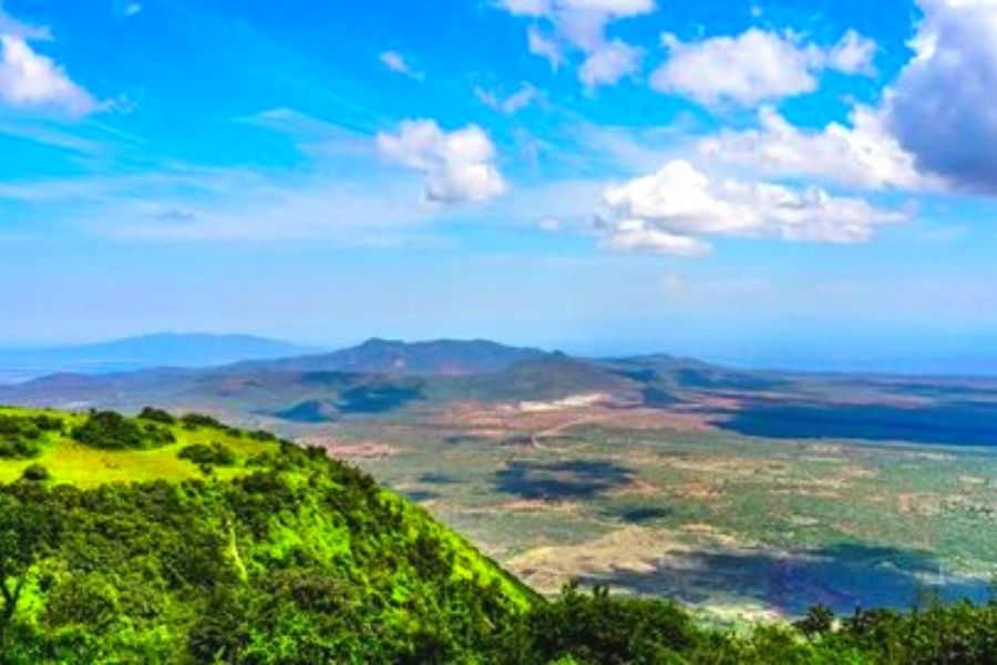
Nairobi’s Ngong Hills, located just south of the city, are part of the Great Rift Valley, rising to 2,460 meters over farmland and Maasai villages.
Background History.
- The hills got their name from the explorer, Joseph Thompson, who camped at the foot on his way to Uganda in 1884. Prior the Masai name for the hills was ‘Enkong'u-e-nchorro-emuny' but Thompson was unable to correctly transcribe it, so he simply called the place ‘Ngong', and the name stuck.
Hills of the Maasai.
- The hills were revered by the Maasai people, who knew them as ‘Oldoinyo Oloolaiser' , which means ‘the mountain of the Laiser' who were one of the mightiest clans of the Maasai, from which the famous ‘laibon', Olonana (Lenana), descended.
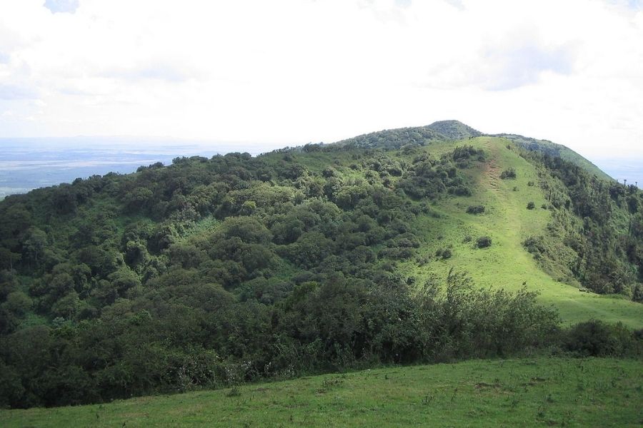
The trail across the ridgeline here is popular among recreational and elite runners alike.
Most runners start from the Kenya Forestry Service station in the northeast corner of the park.
From here, a gently inclined dirt road reaches up to the wind farm atop the hills and continues south with great views along the way.
The route is about 11 km (one-way) to the Kona Baridi bus stop, so runners can either take public transportation back, or shorten the route by doubling back at the highest point (about 10 km round trip).
The imprint of a giant? Or the dirt under God's fingernails?
- According to the Maasai, the hills were formed when a giant, who was stumbling north from Kilimanjaro with his head in the clouds, tripped and fell heavily to the ground, impressing the imprint of his knuckles into the earth.
- Another story claims that the hills are the bits of earth that were left under God's fingernails when he had finished creating the earth.
An extinct volcano.
- Part of the Great Rift Valley Escarpment, the Ngong Hills are actually the remains of a massive volcano, which formed from basalt lava between five and six and a half million years ago.
- Around two million yeas ago, it is thought that the volcano was dissected by faults, which caused its western slopes to drop into the Rift.
A halt on the slave trail.
- The town of Ngong came into being early in the last century, when it developed as a resting place for the slave and ivory caravans heading north.
- It also marked the boundary between Maasai land and Kikuyu land.
Count Teleki's campsite
- In 1887 the hills offered a 2-week campsite for the 700 members of one of the most epic safaris in East African history.
- Led by Count Samuel Teleki von Szek and Lieutenant Ludwig von Hohnel, the safari (which lasted two years and covered 3,500 miles) resulted in the discovery of Lake Turkana and was supported by 700 men carrying two and a half tons of camping gear, one and a half tons of ammunition, one and a half tons of preserves, soap, tobacco, sugar, tea and coffee, a quarter of a ton of alcohol, ten tons of cloth, glass beads, iron wire and cowrie shells, and over three hundred guns.
Stars of ‘Out of Africa'
- The hills featured in the film ‘Out of Africa', which was based on the book of the same name by Karen Blixen.
- The film begins with the words ‘I had a farm in Africa, at the foot of the Ngong Hills', while in the book Karen says that her love of the hills ‘had not it's like in all the world'.
- So fond were she and her lover, the hunter Denys Finch Hatton, of the hills, that when he was killed in a plane crash, Karen buried him on their lower slopes.
- Thereafter the grave became the preferred haunt of a pair of lions; and later Denys's brother erected an obelisk in his honour, inscribed with Coleridge's ‘The Rime of the Ancient Mariner', one of Denys's favorite poems.
- Note: the grave, which is due east of Point Lamwia on the lower slopes of the hills, is now on private land, but can be visited in return for the payment of a small fee.
A favorite weekend retreat
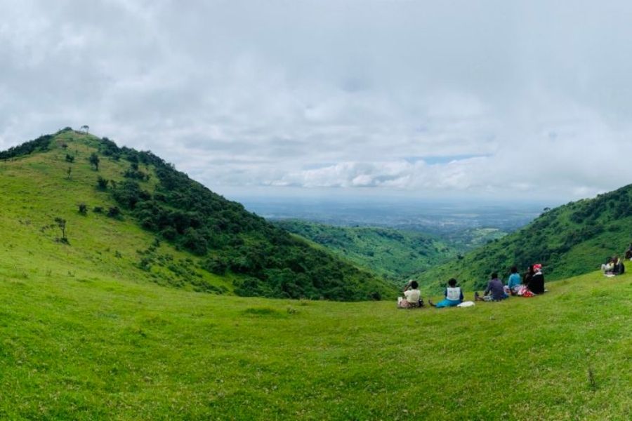
- The sharp spine of the Ngong Hills stretches for 20 km and takes several hours to walk from end to end.
- Once a popular walking and picnicking venue for Nairobi's residents, in recent years the hills acquired a notorious reputation for muggings and attacks on walkers.
- Thanks to the presence of armed KWS rangers who now patrol the area, security is improved and the hills are once again a popular venue for family outings.
Note: it is possible to hire an armed KWS ranger to escort you up the hills , in return for the payment of a small fee.
Panoramic views from the summit
- The summit of the hills is marked by Point Lamwia (2,483 m above sea level), which offers stunning 360-degree views of the Great Rift Valley to the west and the Nairobi suburbs to the east.
Hints.
- Its a popular walking and picnic venue.
- The walk/ Hike takes about 4 to 5 hour to complete, depending on fitness levels.
- It was featured in the film ‘Out of Africa', which was based on the book of the same name by Karen Blixen.
Climate:
- The climate mainly sub-humid and semi-arid with a small pocket of humid climate around the Ngong Hills.
- Short rains occur between October and December, long rains between March and May
Vegetation:
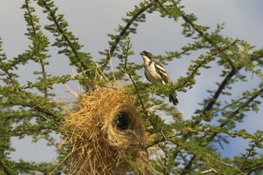
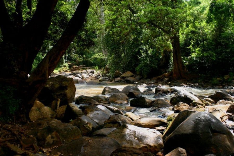
- The eastern side of the hills are covered in montane dry forest and wooded grassland.
- The western side is mainly bushland.
Wildlife:
- The common wildlife to encounter here includes buffalo, vervet and colobus monkey, baboon, duiker, bush pig, water buck and leopard (the latter found mostly in the remnants of indigenous forest along the river valleys).
Activities
- Hiking
- Picnics
- Camping
- Viewing
- Religious activities i.e. prayers
- Team building
- Weddings
Where to stay
- There is no accommodation in the forest reserve.
How to get there
- By road: take the Ngong Road out of Nairobi and proceed via Karen to Ngong Town. At the T- junction in the centre of town, turn right and follow the road around to the left for 1 km (passing Ngong Police Station). Where the tarmac ends, turn right up a rough track, which leads (in 1.9 km) to the KWS barrier.
Kenya Wildlife Service information
The forest reserve is open daily 6.30am - 6.00pm (including public holidays). Entry is free.